Boat navigation basics
Boat navigation involves the process of determining your position on the water and charting a course to reach your desired destination. Here are some boat navigation basics to get you started:
1. Nautical Charts: Nautical charts are detailed maps specifically designed for safe navigation on the water. They provide important information such as water depths, navigational aids, buoys, landmarks, and potential hazards. Familiarize yourself with the charts for your boating area and keep them updated.
2. Compass: A compass is a crucial tool for boat navigation. It helps you determine your heading or direction of travel relative to magnetic north. This information is essential for plotting courses and maintaining a consistent heading.
3. GPS (Global Positioning System): GPS is a satellite-based navigation system that provides precise position information. It allows you to determine your latitude, longitude, and speed over the ground. GPS units are widely available and offer accurate navigation data.
4. Dead Reckoning: Dead reckoning is a navigation technique that involves estimating your current position based on a previously known position, your speed, and your course. By factoring in variables like time, distance traveled, and direction, you can approximate your location. Dead reckoning can be useful when GPS signals are unavailable or as a backup method.
5. Aids to Navigation: Aids to navigation are markers and buoys placed in the water to help guide boaters. They include channel markers, buoys, beacons, and lighthouses. Learn and understand the meaning of these markers to navigate safely through channels and avoid shallow areas or hazards.
6. Rules of the Road: The International Regulations for Preventing Collisions at Sea (COLREGs) are a set of rules that govern the conduct of vessels on the water. Familiarize yourself with these rules to understand right-of-way, navigation lights, and other important regulations to ensure safe navigation.
7. Plotting Courses: When planning a trip, determine the best route to your destination using nautical charts. Consider factors such as water depth, hazards, currents, and the time it will take to reach your destination. Plot your course on the chart and mark waypoints along the way to guide you.
8. Weather Conditions: Always check the weather forecast before heading out on the water. Be aware of wind speed and direction, tides, and potential storms. Unfavorable weather conditions can affect your navigation and safety, so adjust your plans accordingly.
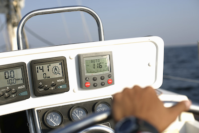
9. Navigation Instruments: Besides a compass and GPS, there are other navigation instruments that can be helpful. These include depth sounders, radar, sonar, and electronic chart plotters. These instruments provide additional information about water depth, underwater features, nearby vessels, and your position.
10. Practice and Training: Boat navigation is a skill that requires practice and continuous learning. Take boating courses or seek guidance from experienced boaters to enhance your navigation skills. Gain hands-on experience by gradually exploring new areas while keeping safety as a top priority.
Remember, boat navigation is a combination of knowledge, skills, and proper equipment. Always prioritize safety, follow navigation rules, and stay vigilant while on the water.


Comments
Post a Comment